
ITHACA, N.Y. — Tompkins County didn’t quite make it to 80°F the past few days (the airport recorded highs of 76°F on the 8th and 10th), but it’s certainly been a warm, dry spell as early spring goes in the Southern Tier. We should see a change to a wetter and cooler pattern for the week ahead, though that’s more in the relative sense, as the rain will be frequent but light, and temperatures top out in the 50s and 60s in this week’s forecast.

Your Weekly Weather
Rain has commenced as a weakening warm front pushes across upstate New York this afternoon. The front is associated with a stacked low currently centered over the western Great Lakes near Chicago. It’s a somewhat strong system, but the low does not have a lot of moisture it can tap into, so don’t expect any downpours, this will be more or less your standard low-intensity pitter-patter.
However, stacked lows are like big rocks in a river – because they extend through the troposphere (the lowest layer of the atmosphere) from the surface to its upper levels, they are tough to dislodge through the flow of the adjacent jet stream, and when they can be moved, that movement is slow. So while the rain will be light, the unsettled conditions will be persistent, and showers will persist over the next couple of days as the stacked low slowly moves east-southeast.
The rest of your Sunday will be grey if mild with that weak warm front ushering in more warm air into the region. Temperatures will top out in the mid 60s, and the rain will taper into scattered showers by sunset after the frontal boundaries passes, though skies will remain overcast. A rumble or two of thunder is possible with some of that late-day heat energy, though thunderstorm activity should remain weak and sparse. Sunday night will remain overcast with occasional light rain showers, and with that cloud cover and moisture, it’ll be a fairly mild overnight low around 50°F. Rainfall amounts look to be between one-tenth and one-quarter of an inch today, with another tenth of an inch possible overnight.
Monday is a confluence of two disturbances, one being that low slowly moving eastward, the other being a weak cold front approaching from the northeast with a low pressure area over Northern New England. This is otherwise known as a “backdoor” cold front because most of our systems come in from the west, our “front door”. Models disagree on whether the front will penetrate deep enough or be strong enough to really cool things off. In the warmer outcome, it fails to penetrate into Tompkins County, with the scattered light rain and overcast skies generated by it and the approaching stacked low, it will be a little cooler with highs in the low 60s. However, should it make into Ithaca and Tompkins, temperatures are likely to only make it into the lower 50s. Monday night will see the showers decrease in number as the cold front is shunted eastward by the stronger stacked low, but it will remain unsettled with scattered showers, overcast skies and lows in the mid 40s. New rainfall amounts during the day Monday will be one-tenth of an inch or less in most areas, and less than one-tenth of an inch overnight.
Tuesday will see the stacked low continue its slow march eastward, decaying as it goes. We should see cooler air ushered in on its backside as its counterclockwise circulation crosses Ithaca’s longitude, but that decay should limit showers and coolness – mostly cloudy skies, an isolated shower or two, and seasonable highs in the upper 50s are likely. Tuesday night may see a few more light rain showers as the warm front “tip” of another storm system developing over the western Great Lakes clips the Southern Tier, but otherwise mostly cloudy skies will prevail with lows in the low to mid 40s.
Wednesday is yet another unsettled day, but by no means a washout. The developing upper-level low over the Great Lakes begins to trek east-southeastward, and its unstable air will set off a few scattered light rain showers, moreso in the afternoon with daytime heating, and result in mostly cloudy skies with highs in the upper 50s. The low enters Western New York by Wednesday night, and you’ll want an umbrella as occasional light rain showers mix in with mostly cloudy skies as temperatures bottom out in around 40°F. There is a small chance some wet snow could mix into the showers on the highest hilltops Wednesday night, though it doesn’t look to be anything substantial at this time.
Thursday will start off mostly cloudy with lingering rain showers, and consensus shows some clearing by late in the day as highs climb into the low 60s – however, this also comes with lower forecast confidence than usual (with the models in such discord this week, thankfully this isn’t a high-stakes situation). Some models (the European ECMWF model, particularly) show a slower-moving upper-level low, so don’t be shocked if the showers linger into the afternoon and we end up only reaching the mid 50s. Thursday night will feature partly cloudy skies and lows in the upper 30s, though if the slower movement pans out, that would be cooler with rain showers with a few higher-elevation snow showers before clearing out Friday.
Friday is somewhat dependent on which Thursday outcome pans out, either starting partly to mostly cloudy and showery before clearing out in the afternoon. Or fairly dry and mostly sunny throughout the day. In either case, the later afternoon on is expected to be dry as high pressure briefly builds in, with highs either in the lower 50s (the slower storm scenario) in the lower 60s (the faster scenario where it’s already moved away). Friday night will be dry and partly cloudy with lows around 40°F.
Saturday will be the nicer of the weekend days, with partly cloudy skies and highs in the mid 60s. A new storm system is forecast to begin to make its way into the Southern Tier later Saturday and into Sunday, with mostly cloudy skies, scattered showers, and highs around 60°F.

Extended Outlook
Looking ahead into the second half of April, a deep and expansive area of cold air is expected to settle in thanks to a large amplitude jet stream trough over the middle of the continental United States, with ridges over the West Coast and just off the East Coast, which will oscillate enough to allow for potential warmer-than-normal conditions for the Northeast before the just stream trough and cool air mass shift slightly eastward. Nothing shows a cold snap for the Southern Tier, it’s more or less the nosebleed seats at the stadium as the abnormal cold settles in over the southern Plains and Texas.
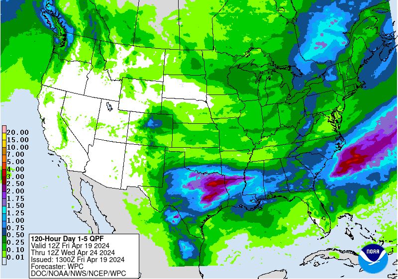
Perhaps of bigger concern is that this also looks to be a drier than usual period, both in the 6-10 day and the 8-14 day data. While we should pick up some new precipitation this upcoming week, overall it’s likely to be around an inch or less, which will provide some if limited benefit as upstate New York continues to be parched.